C-RTK3 X20P (PX4) Configuration Guide
This chapter applies to using the C-RTK3 X20P with the PX4 flight stack (smart controllers running PX4 firmware).
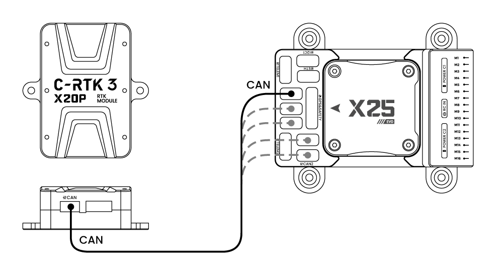
[!NOTE] The C-RTK3 X20P supports connection to the controller via CAN (DroneCAN) and UART. CAN is recommended. Before configuration, please mount the antenna with a clear view of the sky. Avoid placing near windows or other obstructions, as this may prevent obtaining good positioning data.
Using DroneCAN
Enabling the C-RTK3 X20P
[!NOTE] After setting the following parameters in QGroundControl > Vehicle Setup > Parameters, reboot the controller.
| Parameter Name | Value | Comment |
|---|---|---|
UAVCAN_ENABLE |
"Sensors Automatic Config" |
Enable automatic configuration of UAVCAN sensors |
EKF2_GPS_POS_X |
(Fill in according to actual installation, unit: meters) | Set the offset of the antenna from the vehicle center of gravity (CG). Example: If the antenna is 25cm forward of the CG, set EKF2_GPS_POS_X to 0.25 |
EKF2_GPS_POS_Y |
(Fill in according to actual installation, unit: meters) | Set the offset of the antenna from the vehicle center of gravity (CG). Example: If the antenna is 25cm to the right of the CG, set EKF2_GPS_POS_Y to 0.25 |
EKF2_GPS_POS_Z |
(Fill in according to actual installation, unit: meters) | Set the offset of the antenna from the vehicle center of gravity (CG). Example: If the antenna is 25cm below the CG, set EKF2_GPS_POS_Z to 0.25 |
UAVCAN_PUB_RTCM |
Enable / UAVCAN_PUB_MDB |
If using RTK, subscribe to PX4 forwarding RTCM data to the base station |
UAVCAN_SUB_GPS |
Enable |
Enable UAVCAN GPS data subscription |
UAVCAN_SUB_GPS_R |
Enable |
Enable UAVCAN backup GPS data subscription |
[!NOTE] The C-RTK3 X20P is a single-antenna positioning module. There is no need to configure dual-antenna heading-related parameters (such as
EKF2_GPS_CTRL,GPS_UBX_MODE, etc.).
Verifying Positioning Information
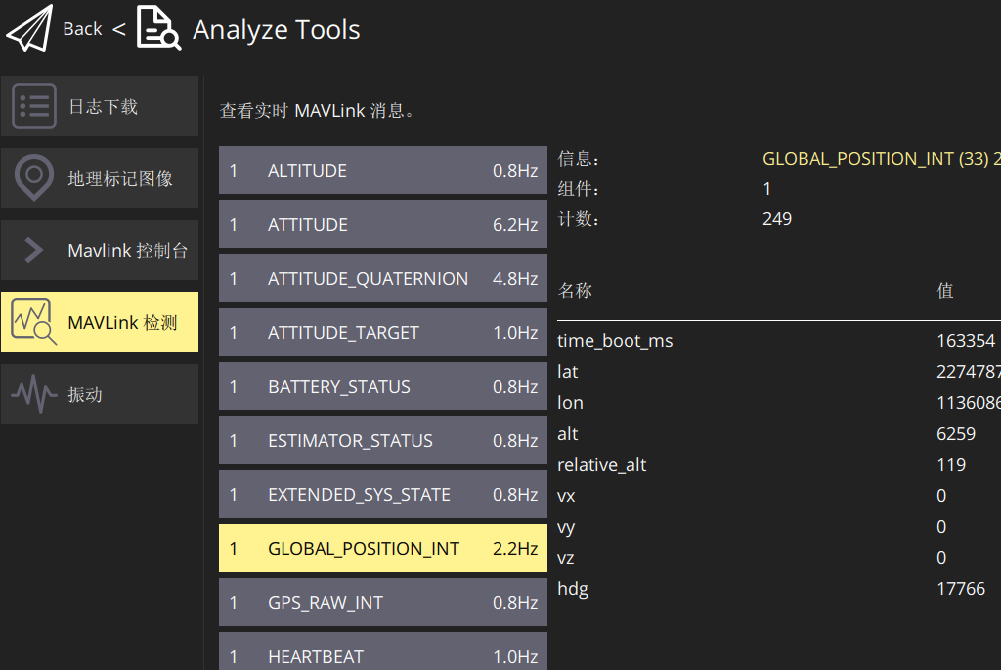
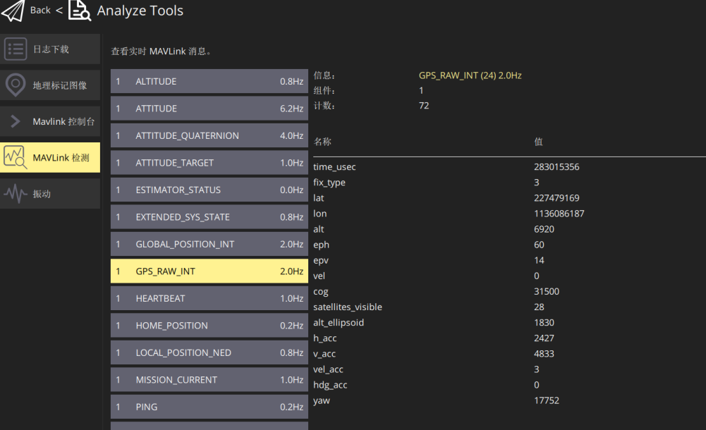
- After configuration, place the vehicle outdoors in an area with a clear view of the sky and wait for GPS lock. Once the GPS has a valid fix, check the positioning status in QGroundControl > MAVLink Inspector > GPS_RAW_INT and confirm that an RTK Fixed solution is obtained.
- Check the latitude, longitude, and altitude in GLOBAL_POSITION_INT to verify the positioning data is correct.